August 2nd – 18th, 2016
The Big One. 17 days and 16 nights through the heart of the Temagami wilderness. Our longest, most challenging, most spectacularly scenic route to date. This canoe trip took us on a journey of over 250km through some of the most rugged terrain in the region, with abundant wildlife, magical old-growth forests, sacred spiritual sites and ancient portage trails in use for over 5000 years, through areas of historical significance in relation to industry and environmental activism, and travel upon 5 rivers and 31 different lakes.
[googlemaps https://www.google.com/maps/d/embed?mid=1NXkARb3FbOuek8OYQPUapkRlIeA&w=1280&h=700]
PART ONE: Against The Flow To Flo
Alternate Title #1: Always A Headwind
Alternate Title #2: I Fucking Hate Alder Bushes
August 2nd-7th, 2016

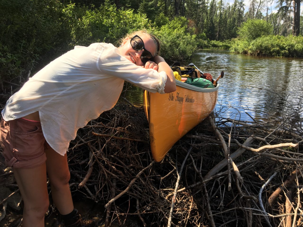
canoes by the dock at smoothwater outfitters
Months of research, food preparation, canoe repairs, and map reading found us at Smoothwater Outfitters and Eco Lodge on the first of August where we had lovely accommodations and a fabulous dinner before beginning our voyage. We had driven up to the lodge in record time and counted over 140 canoes heading in the opposite direction on the highway after the long weekend. We congratulated ourselves for being so clever with our timing. Had a nice chat with our dinner companions, a family from Peterborough, and Johanna Kilbridge who co-manages the lodge with her partner Francis Boyes. The night before our trip was spent re-organizing gear and food supplies and we were both looking forward to getting on the water the next day.

the main lodge building
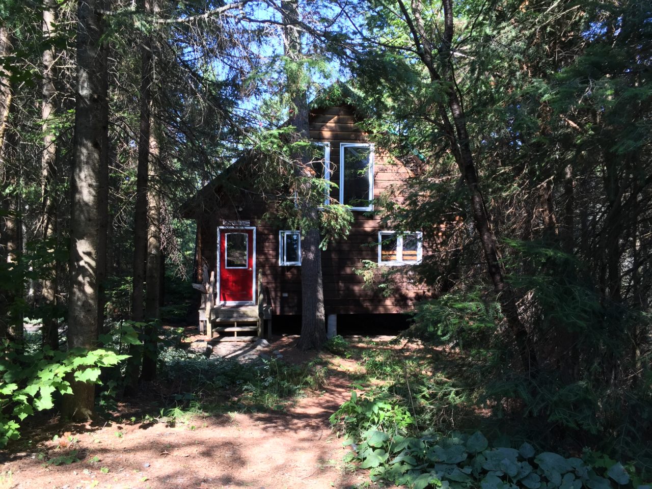
the “gathering hall” at smoothwater – a place for trip prep

guest cabins
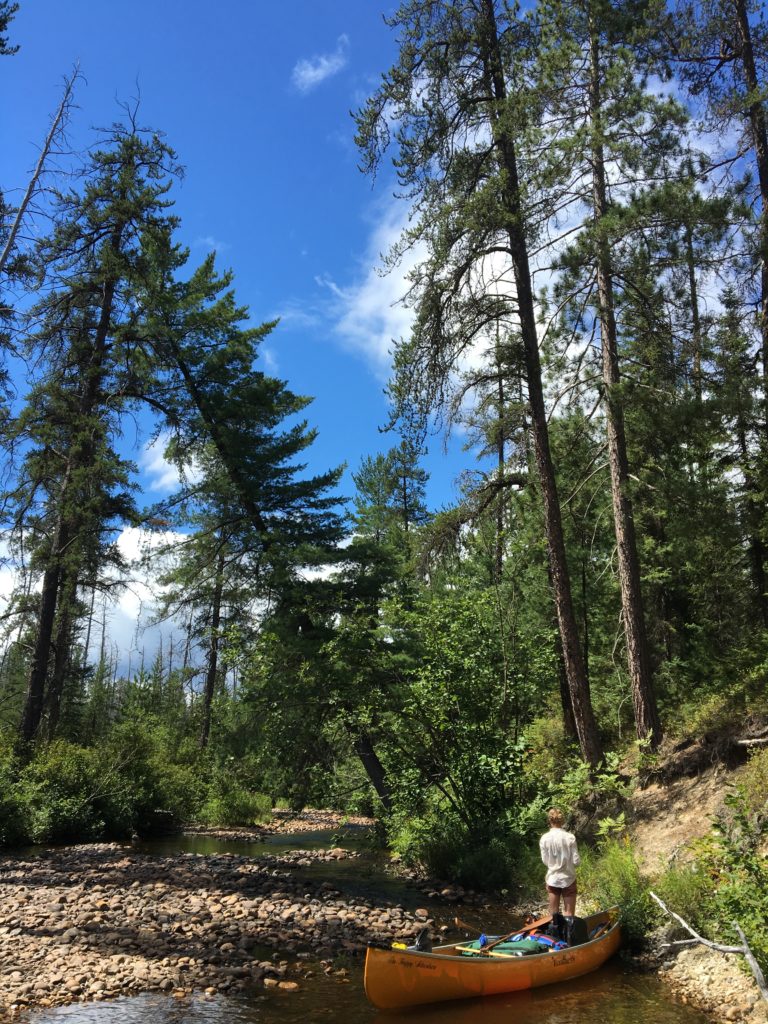
Day 1: Ferguson Bay to Devil’s Bay, Lake Temagami (12.2km)

me and the taco and the happy adventure, featuring hillbilly rack deluxe

temagami’s easiest portage: from parking area to sandy inlet
After a nourishing muesli breakfast prepared by Johanna at the lodge, we finalized some last-minute details and obtained our camping permits before driving down the Red Squirrel Road to the Ferguson Bay access point. Andrew’s new truck with homemade hillbilly canoe rack tackled the rough road with ease and we shared a beer before lazily triple-carrying our gear down to the beach from the parking area. It was sunny, hot, and windy, and we went for a quick swim before hopping in our canoe and setting out across Lake Temagami.
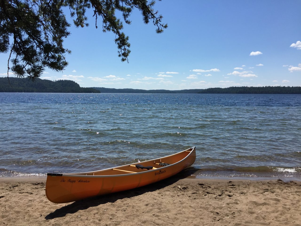
sandy inlet on ferguson bay, lake temagami
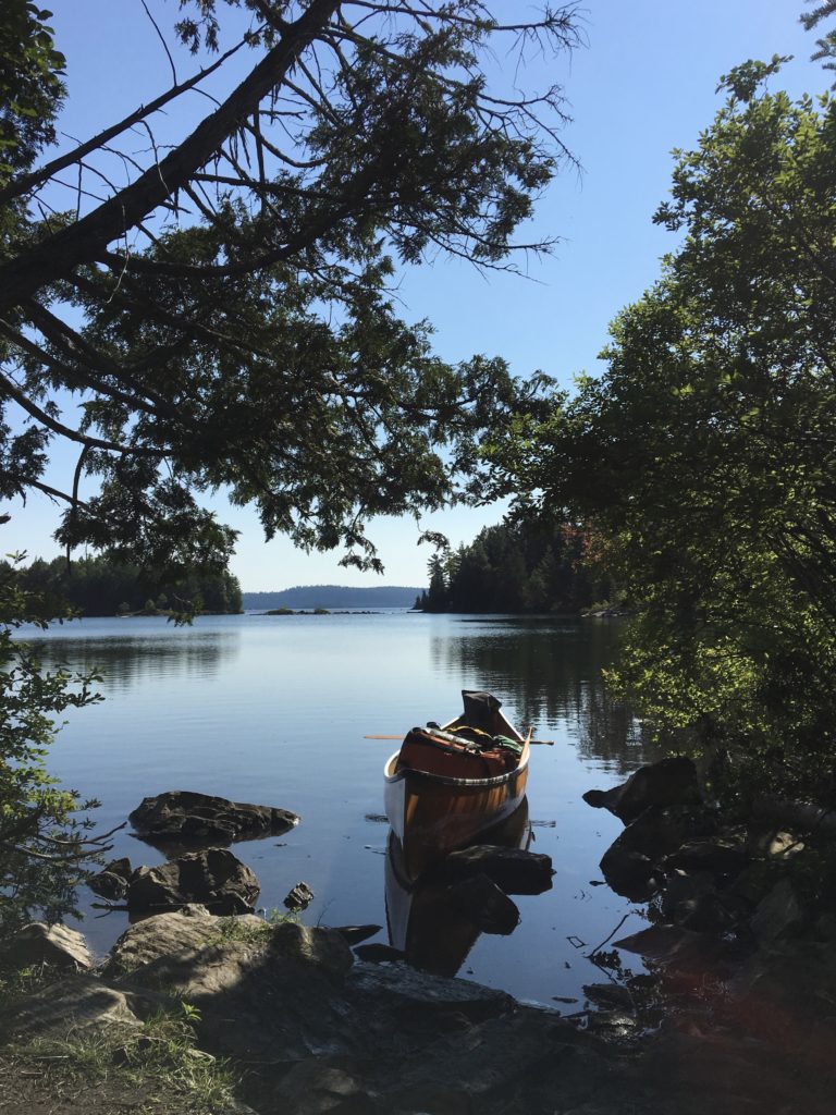
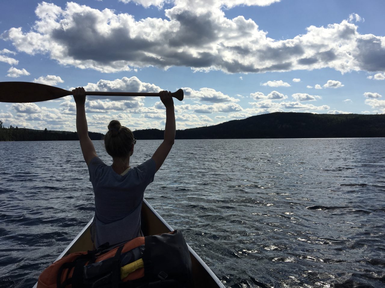
It’s an enormous lake, and we were paddling against a stiff headwind into high waves almost immediately. Andrew’s birthday gift, a beautiful Norquay paddle, lasted all of two kilometres before cracking horribly right down the blade. From this point on the paddle had a leisurely tour of Temagami, carted around in our canoe and by hand for hundreds of kilometres. Thankfully, Andrew had brought along his trusty Badger paddle too, and we hugged the coast until we made a difficult crossing of Devil Bay through some severe whitecaps and rollers. We had planned to make it to Obabika Inlet on the first day, but our late start and the wind forced us to seek shelter on a big campsite a few km from the portage to the inlet.

devil bay campsite

thorough testing of new camp chairs – a very important task

this campsite even had a pizza oven! we were having steak, though, so we used it as a kitchen counter instead
Hot hot hot. Went for a dip before dinner (steak and a bean salad I had made the day before). Tested new camp chairs (Helinox Ground Chairs) and found them to be excellent. Chased away several voles from our food supplies and were attacked by vicious biting houseflies. In the tent shortly after sunset to escape mosquitoes.
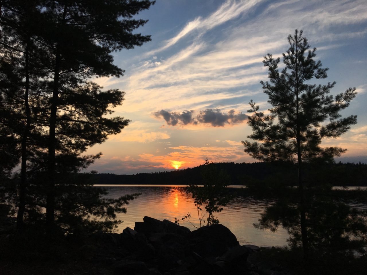
sunset over lake temagami
Day 2: Devil Bay to Obabika Lake (16.5 km)

packing up after breakfast on lake temagami
starting off the day right with soaking wet boots

waiting at the portage for ‘space trucking’ and ‘maximus’
Another hot morning. Coffee, breakfast, packed up and loaded by 9 am for the paddle down Devil’s Bay to the Obabika Inlet portage. Passed by and then caught up with group of slightly older guys using Keewaydin wannigans and cedar-canvas canoes at the portage. Bit muddy at the takeout, but 600m of straightforward and relatively flat trail. Battled bit of a headwind across Obabika Inlet to the next portage, where we came across a boys’ camp spread out across the takeout. One of the young campers had an injured ankle and was being evacuated. As we waited in our canoe for the group to gather itself and move out of the way, a group of girls from Camp Wabun came across the portage with their wannigans and canvas canoes. Very impressed by their organization and teamwork, as well as their traditional gear.
the happy adventure patiently awaits unloading

i try my hand at portaging the canoe but decide i still prefer the (much heavier) barrel
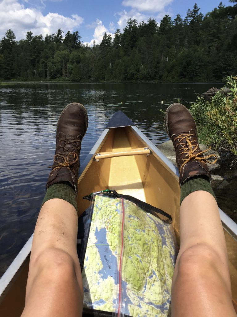
one muddy boot, one wet, the friends of temagami map, and the start of an awesome sock tan

obabika inlet
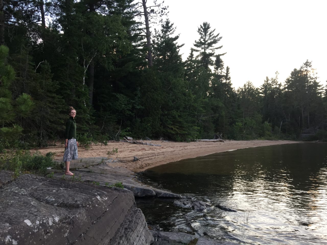
On the trail (probably the easiest 800m portage in all of Temagami) we ran into another camp group from Philadelphia heading the opposite direction. Waited out a brief thunderstorm at the far end of the portage and chatted with one of their leaders, then took advantage of a very calm and still Obabika Lake and raced across to the western shore and north to find a campsite. Caught up with group of older guys who had made camp during the storm a few km away. Seeing more dark clouds whipping up behind the hills, we paddled hard and fast to the next cluster of campsites and quickly set up our tent and tarp in case of another downpour without exploring our site too much. After the clouds disappeared and the threat of rain vanished, we were pleased to discover that on the back of our campsite we had our own private beach!
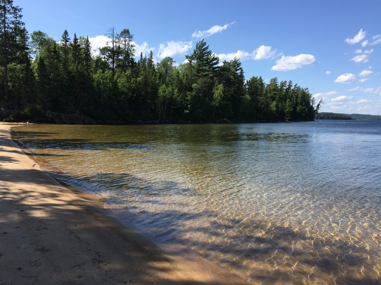
lovely beach behind our campsite

looking across to ranger point from the beach. you can just barely make out the white prospector tents of outpost co in the background
We went for a swim, shared a beer, and made poutine with smoked sausages for dinner over the fire. Our campsite was directly across from Ranger Point, where Outpost Co has set up some glamping tents and offers a private chef to its clients. It’s a point of contention amongst the Temagami locals as the location they’ve chosen is crown land and occupies two prime sites next to a cool-water spring. We were curious, but didn’t see much activity across the lake and didn’t feel the need to detour from our intended route to see what all the fuss was about. Lovely quiet evening.
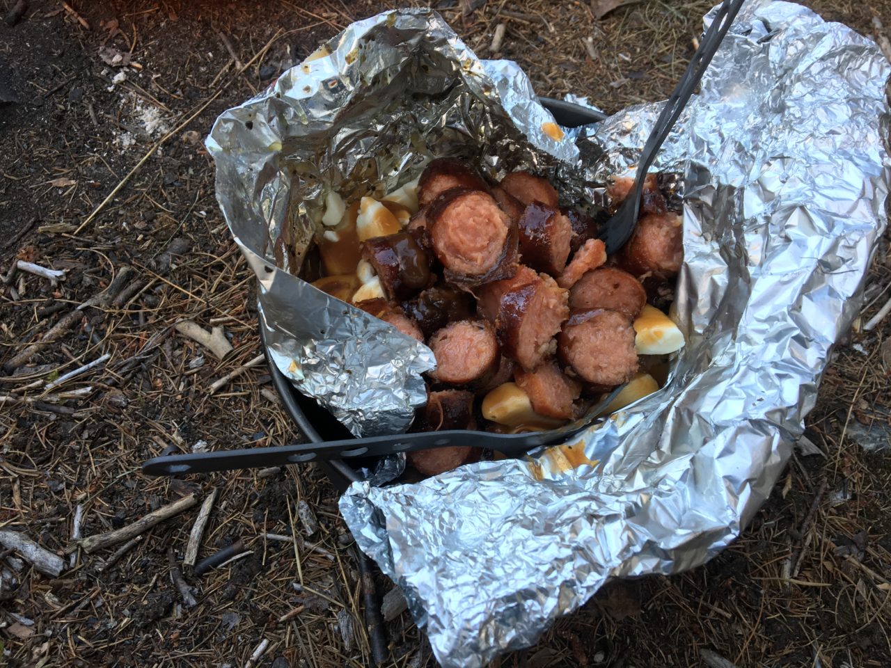
roasted potato poutine with smoked sausages – one of my more brilliant meal ideas

soaking it all in
a tree/zebra hybrid creature takes an evening stroll on the beach
Day 3: Obabika Lake – Obabika River – “Kwa-pwa-say-ga” link – Lahay Lake (17.2km)

andrew wakes up with the sun on obabika lake

ooOOOoooh, beach sunrise

at least the norquay paddle photographs nicely
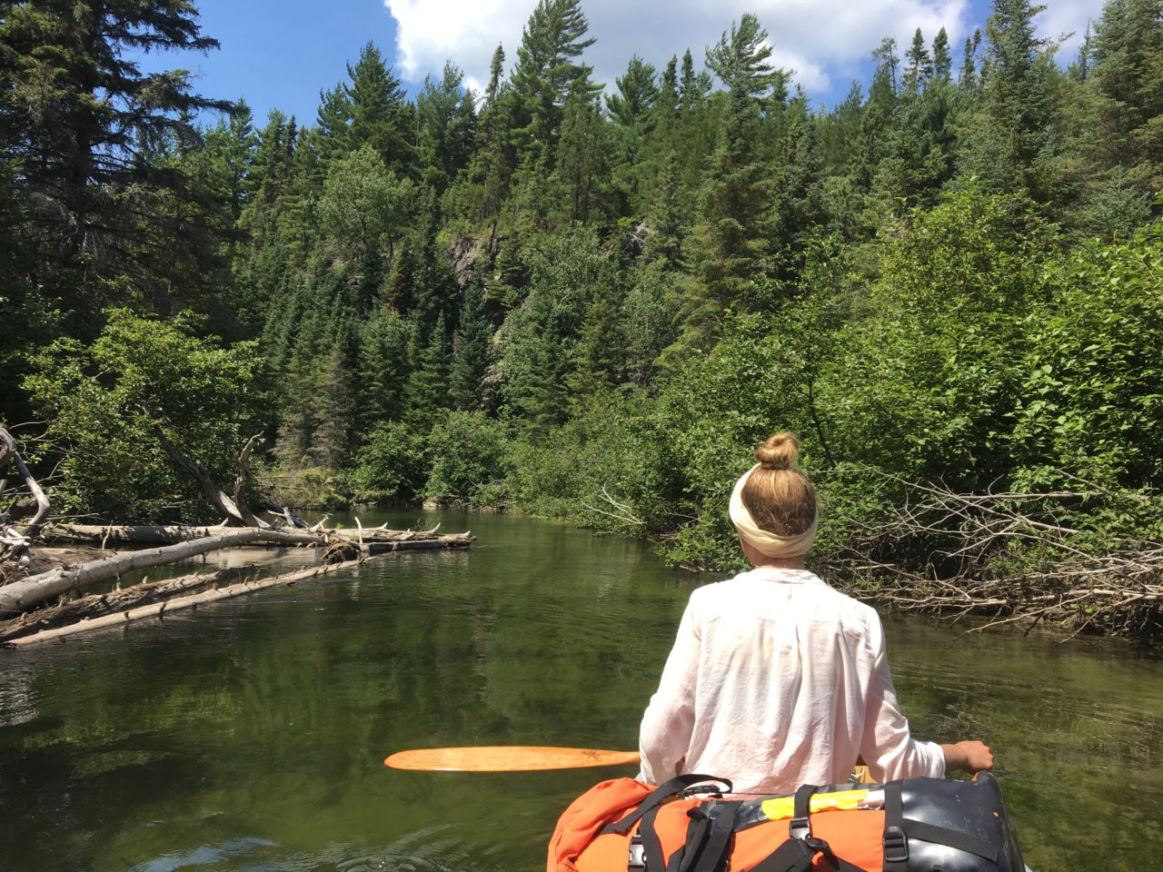
Morning swim from the private beach after coffee, breakfast, and packing up. Paddled north to mouth of Obabika River and saw Alex Mathias’ homestead (aboriginal elder who lives on traditional family grounds off reserve). Didn’t see anyone around so set off downriver, floating over huge fish which excited Andrew greatly. Shortly before a small portage around an old dam, I saw a black furry face on the shore. BEAR! As soon as I yelled “Andrew, a bear!” it crashed away through the bushes and he didn’t even have the chance to see it. I was glad it ran away, as wild bears should. My heart was racing. We chose the shorter of two portages around the dam on river left and ran the small rapid just below. After many winding wiggles of river we passed a group of Keewaydin campers who were paddling upstream. They had come from Lahay Lake, which was where we were headed ourselves.

setting off down the obabika river
below the collapsed dam/little rapid
another hot day. we kept soaking our shirts to cool off
Found the takeout for the 380m portage into Kwa-pwa-say-ga next to a shallow creek, which was rather overgrown with ferns. Put in too early and paddled straight into a bog which swallowed Andrew up to his thighs when we tried to lug our gear across it to the lake proper. By the time we reached the next overgrown portage into a small pond, I was very hot and hungry and cranky, so we made a quick lunch of rehydrated white bean dip and pitas and chugged a full litre of lemonade.

rehydrating some tasty white bean dip. there’s a portage around here somewhere!

sweating my lady-balls off on the steep and overgrown 600m portage
The start of this ~600m portage was full of blowdowns and quite steep, and with our heavy packs we had to take a short break halfway up the hill before continuing on. The next little lake was quite pretty, but we got a bit muddy again at the takeout for the portage into Lahay Lake. This trail was easier and shorter than the last at about 360m, and culminated at a campsite next to an old, decaying prospector’s cabin. Poked around a bit at the ruins and set up camp, then went for a quick dip in the lake and tangled our feet in some gross reeds before preparing halloumi and vegetable skewers and our final beer for dinner. Our zucchini had already succumbed to the hot temperatures and was quite slimy and wet, so after supper Andrew built up the fire and we torched the lot of them until nothing was left. Farewell, fresh vegetables. You will be missed. Our tent was pitched on a patch of blueberry bushes (the only semi-flat spot around) and we slept easy, knowing we had left the bear far behind us.

andrew steers us towards the final portage of the day

yay, more mud!
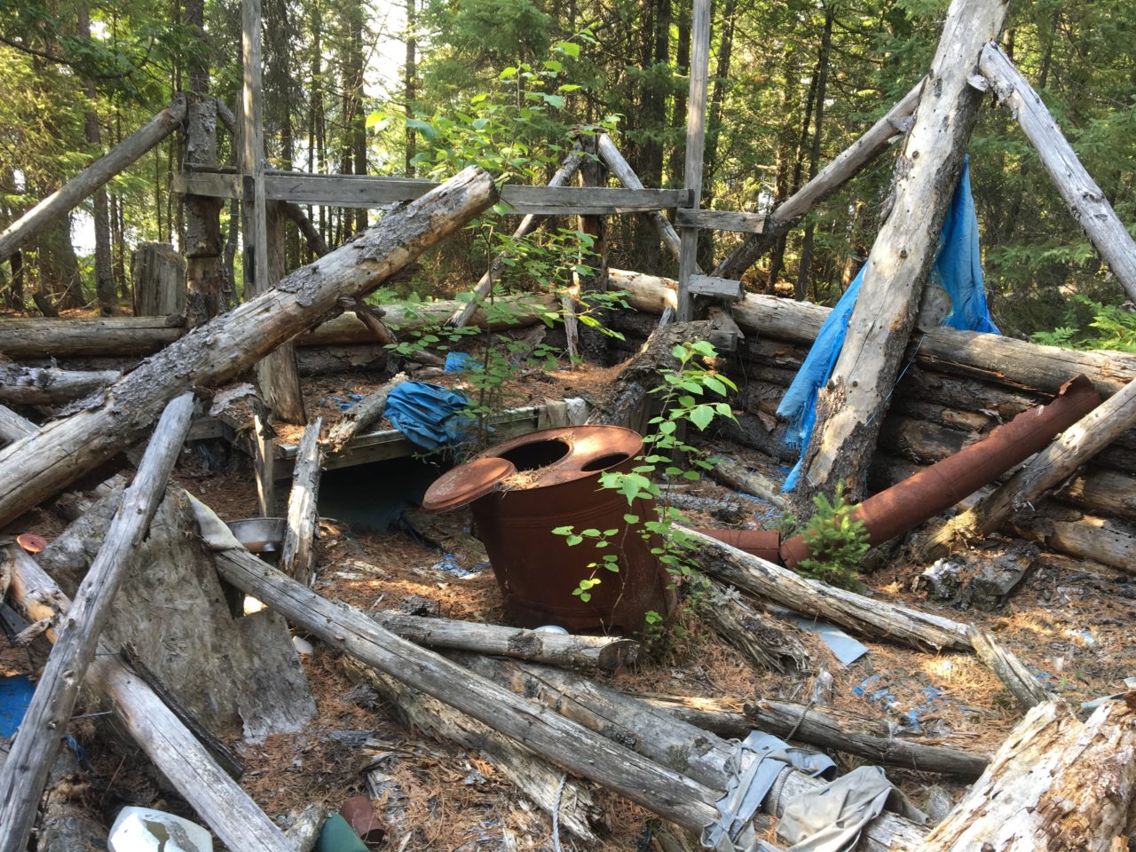
old prospector’s camp on lahay lake

last portage of the day

lahay lake
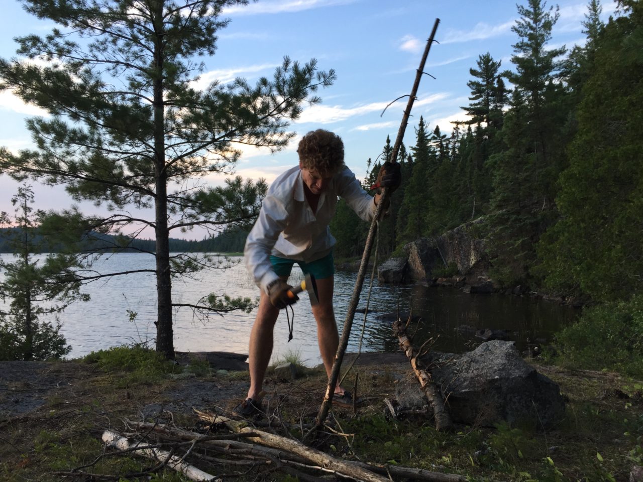
andrew processing firewood

halloumi and veg skewers, minus rotten zucchini
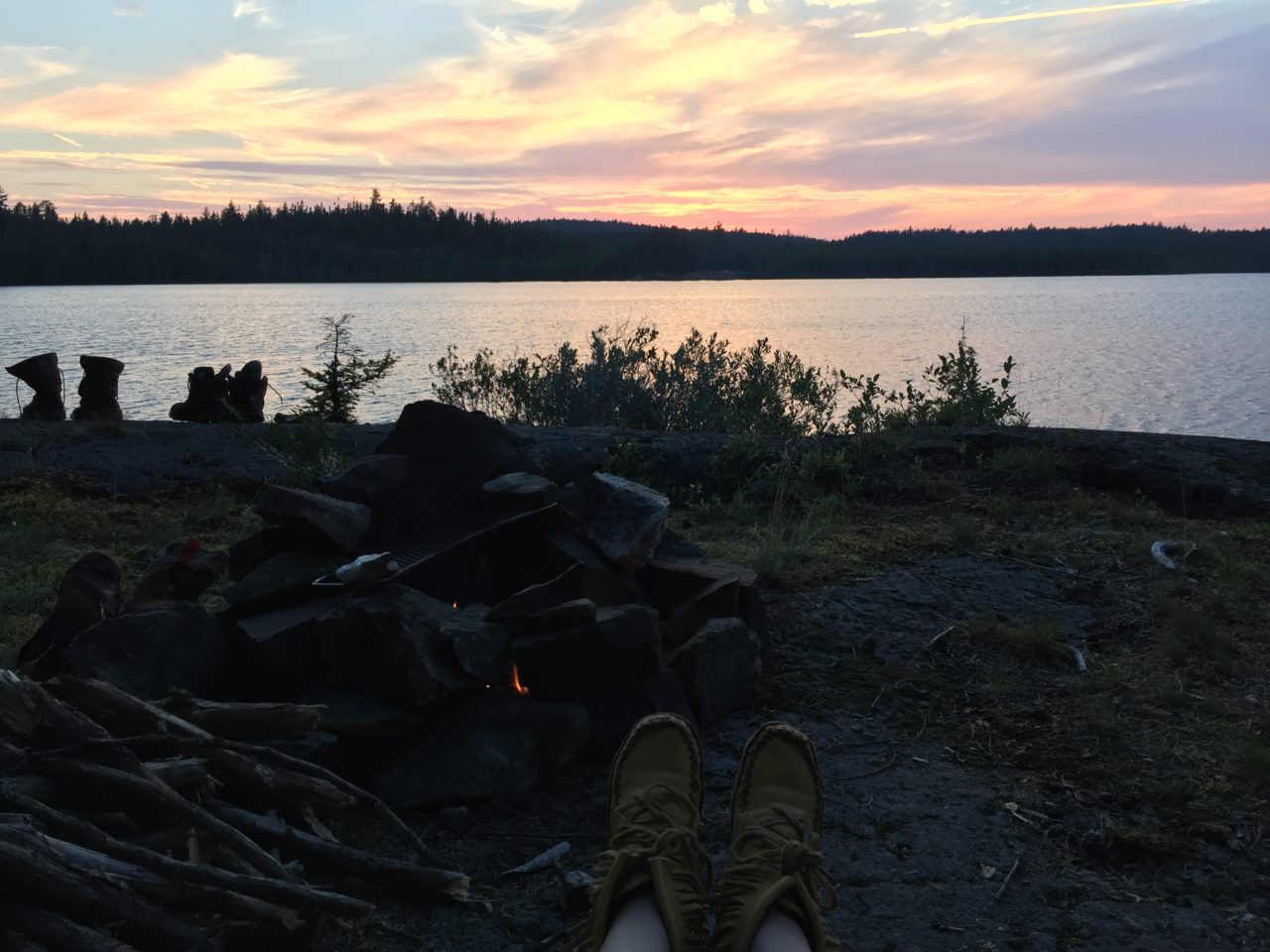
my moccasins enjoying another nice sunset. how boring.
Day 4: Lahay Lake – Nasmith Creek – Dorothy Lake (11.1km)
bit of a wet morning on lahay lake, ‘interesting’ tent pad

the happy adventure doesn’t mind the rain
entering the nasmith creek
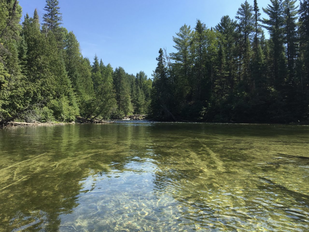
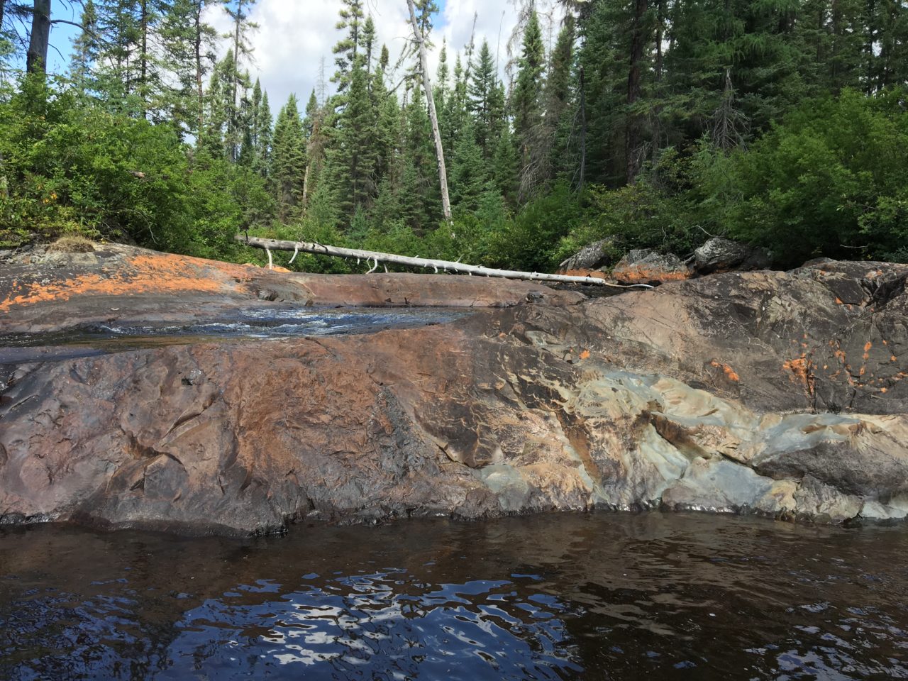
Spot of drizzle in the morning and had coffee and oatmeal under our tarp after packing the rest of our gear. Paddled under cloudy skies to outlet of the Nasmith Creek. The Nasmith was very interesting and around every bend we saw different environments and trees, starting with some impressive old-growth forest, changing to black spruce and tamarack and jack pine.

up the creek
first official liftover marked on the maps
Several log jams, beaver dams, and liftovers around little cascades before our first official portage of the day around a series of waterfalls. We elected to take a lunch break at a campsite beside one of the falls which was extraordinarily pretty, and then shortened the overgrown portages by paddling between the different sets of falls.
old blaze on the portage around a series of waterfalls/up to my thighs in ferns

all smiles

pretty spot for a lunch break
there’s another (unmarked) campsite directly across from this one. both are lovely.
shortening the 655m portage by paddling the flat water between waterfalls
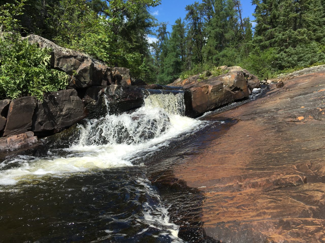
last of 3 waterfalls along the 655m portage
Lost count of beaver dams and log jams we negotiated on this stretch between portages. The next official trail was a short 120m around another little waterfall, and we stumbled upon plenty of blueberries, snacking as we carried our loads. From here the Nasmith opened up into a vast wetland, and we checked our navigational aids several times to ensure we stayed on course. Beaver dam, logjam, logjam, beaver dam, in and out, up and over and down the other side, squelchy boots, mud everywhere.
getting rather tired of beaver dams by this point

oh goody! i love beavers!

…and now a log jam, just for some variety

running out of water. i look extremely happy here.

in the words of dorothy parker, WHAT FRESH HELL IS THIS?!

surprise! another beaver dam as we enter the nasmith wetlands
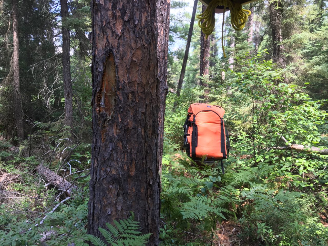
We must have lifted over close to 40 different obstructions on the creek until we ran out of water and waded upstream, dragging our canoe to reach a steep 270m portage through a jack pine stand to Dorothy Lake where we would make camp for the night. We were very pleased with the site on Dorothy. It was set amongst tall red pines and blueberry bushes and there was a lovely three-walled fireplace with lots of neatly stacked and split wood at the ready. Shortly after arriving, two canoes came across the lake carrying six dudes with handkerchiefs tied like bonnets on their heads. They were the first people we had seen all day, and as it was getting late we offered to share our site with them. They declined and pushed on through to the next lake, leaving us to enjoy the setting sun, glasses of bush sangria, and a large pot of chili all by ourselves. We stayed up a bit later this night, although the mosquitoes were quite bad, and sipped on hot chocolate with Creamy Beige for dessert.

andrew tries to estimate how long it will take us to finish the nasmith creek. all signs point to a whole lot of wading.

dorothy lake campsite
Day 5: Dorothy Lake – Nasmith Creek – Chapin Lake – Sawdust Lake – Pox Lake – Tiny Lake – Pinetar Lake – Livingston Lake – Beaver Lake – Ojidawanmo Lake (9.2km – mostly walking)

dorothy lake campsite in the morning
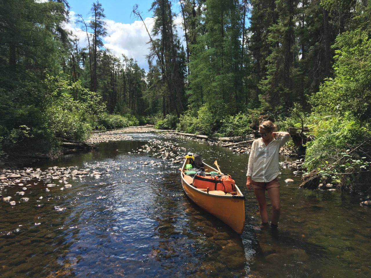
As we were packing up our site, a group of Taylor Statten girls paddled into Dorothy and over to the portage leading back to the Nasmith Creek. We said hello, finished our breakfast, and set off after them. Spent a few hours wading up the creek, dragging our poor canoe through shallow, rocky channels, adding some yellow paint to the already-colourful rocks until we reached a short 90m portage over an old road into a (creepy) swamp full of standing dead trees.
i appreciate the assistance, andrew

well on my way to developing trenchfoot
the map said, “shallow – wading may be required”. no kidding.
if you don’t like getting your feet wet/scraping your canoe, i advise against travel on the nasmith creek

happy to have found a real portage over an old road – creepy swamp beyond

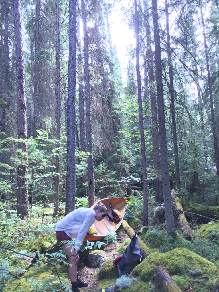
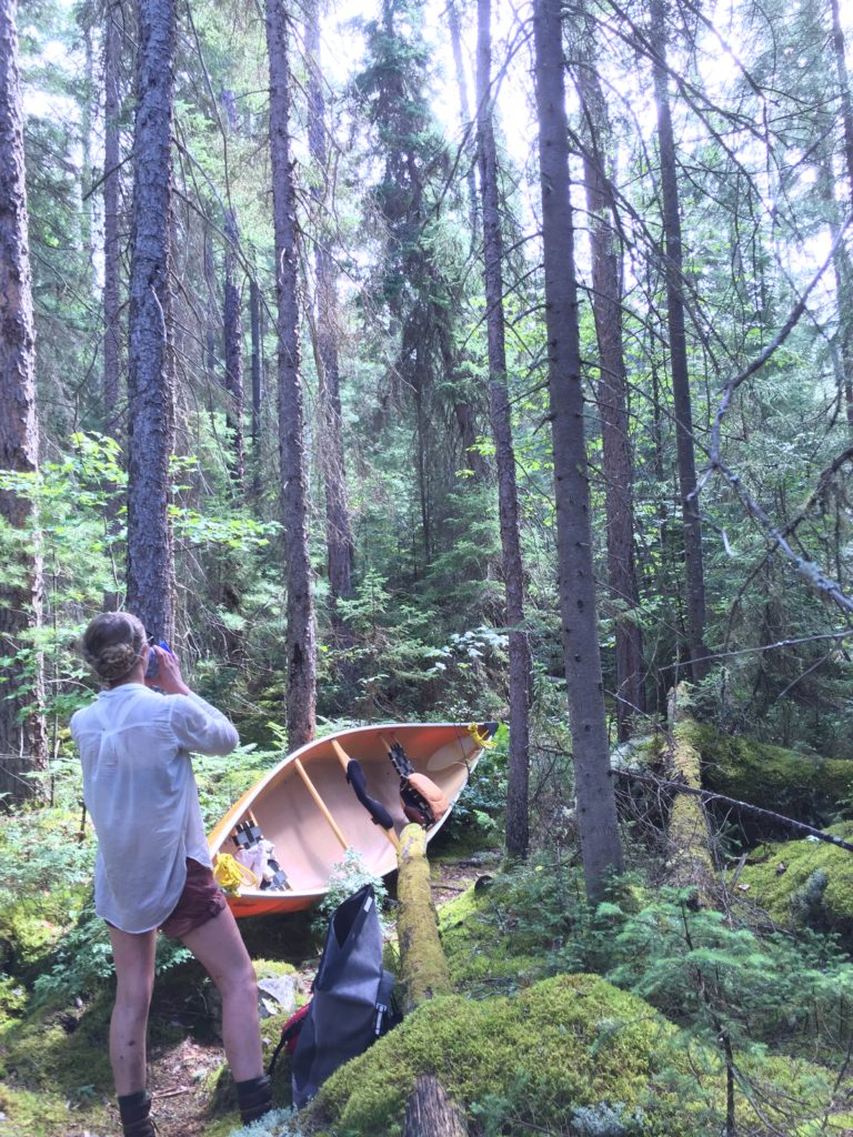
1300m portage straight up a mountain from the nasmith creek
“just leave me here to die!”
sweaty mess
Had a lunch break before tackling the most difficult portage we’ve ever done. I had been warned about this route by a Keewaydin tripper I met through Instagram, who started his journal entry for this section with “This is the worst day of my life!”. The trail from the Nasmith Creek to Chapin Lake climbs 120 vertical metres and is close to 1.3 km long. It is overgrown, littered with blowdowns and boulders, and particularly nasty heading east to west. I thought I was going to die. At times I was crawling on all fours with the barrel on my back, sweating profusely, glasses fogging up and sliding down my nose, getting mauled by mosquitoes in the hot, still air. Saw the girls’ camp in their canoes across Chapin after our first load. It began to rain, then pour, and we began the steep descent back to the start soaking wet and already exhausted. The deluge stopped in time for us to begin the climb back up the mountain, which was even more of a challenge once the rocks were slick with rain and the mosquitoes came back for their dessert. Worst portage ever.

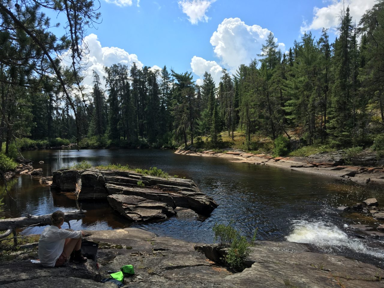
sun-shower on pretty little turquoise chapin lake

eating trail mix
Catching our breath on Chapin, we took note of how clear and blue the water was and how much closer we were to the clouds after climbing so high. The little mountain top lake chain we were passing through was incredibly beautiful, and we paddled across to another overgrown 200m portage into Sawdust Lake which had many sandy-coloured rocks along the shore, then a short 30m trail into Pox Lake, 90m to Tiny Lake where we saw little sundews, 175m into Pinetar, 60m to Livingston, and then a longer 390m hike to Beaver Lake which had a very steep descent to the put-in (but at least we were carrying our loads downhill).

every lake across the misabi range had gorgeous, clear water
tiny lake is tiny

sunny again

looking back up the portage from livingston to beaver lake
This was where we had planned to stay, but spying a boys’ group parked on the opposite shore forced us to bush-push north 50m to Ojidawanmo Lake where we knew there was one more campsite. Upon exiting the bay towards the island camp, we came across the Taylor Statten girls, bathing naked in the water. We said, “Sorry! Not looking!” and they squealed and ran to cover themselves. We were so tired. We had nowhere to stay for the night as all the sites in the vicinity were occupied. As we made to circle back and carry over to where we had come from, entertaining the awful idea of portaging an extra kilometre in total darkness, the girls (now dressed) called out to us. “You’re welcome to share our site if you can’t find anything else!” “Are you sure? We have lots of chocolate to share! Thank you so much!” we replied. We asked about their trip and learned they were on day 34 of a 42 day expedition from Biscotasing to the Taylor Statten Outpost on Maskinonge Lake! They offered to help us unload but we declined, and we set up our tent in a bush just behind one of theirs. The site was seldom used and didn’t have much in the way of tent pads and there was no firepit we could discern amongst the ferns and mosses. The little island probably hadn’t seen any campers in years and all of a sudden 11 people were sleeping on it for the night. I dug through the food barrel and produced two bars of chocolate to give to the girls as thanks, and they were very grateful. Andrew was extremely disappointed with me when I said we still had four bars, not knowing he had stashed an extra two in our snack bag and that was why he was so concerned that with only four bars (actually six), we wouldn’t have enough treats left for the rest of our trip. I called him a stingy miser; he said I was far too generous. I thought that after sneaking up on the girls while they were in various stages of undress and them still offering to share their home warranted at least two Ritter Sports. Grumbling at each other, we quickly rehydrated some Three Sisters Soup (one of our favourites) and sat on our overturned canoe to eat while the girls did their dishes and retired to their tents to read. Right after we finished our soup we went to bed to the sounds of giggling, and we slept like the dead after our difficult day of hiking with a canoe over mountains.

i think this was on livingston lake. we went through so many that day it’s hard to tell which is which! i do know that we stopped taking photos somewhere around there… too tired and worried about finding a campsite
Day 6: Ojidawanmo Lake – Beaver Lake – Two pond hops – Lewbert Lake – Ames Creek – Skooztagan Lake – First Lake – Florence Lake (11.2km)

our amazing neighbours, the taylor statten girls, looking strong and beautiful on day 35 of their 42 day expedition…

…and me, a weakling compared to the teenagers
Woke to the sounds of the girls quietly preparing breakfast and packing their tents. We slowly rose and began packing our gear while brewing coffee and finding the muesli. We talked with the girls about their incredible voyage so far, and learned they were also heading to Florence Lake. They asked to see our maps with portage information on them as they were relying exclusively on outdated MNR topographical charts. We told them our intended route and one of the leaders shouted “HALF DAY!” with glee as they had anticipated having to travel quite far south in a big roundabout loop through Pinetorch Lake rather than take the Lewbert shortcut to the Ames Creek. I asked to take a photo of them before they set off and they obliged. A truly amazing group of young women. Wish I had been that cool at fifteen, but I spent my summers in a dark theatre singing musicals when I was their age. They were on the water shortly after 8 and we were not much later in setting off. They were single-carrying their heavy canoes and wannigans, and we did not catch up with them again for a long time.

“bye, campsite!” – ojidawanmo lake

climbing back up the portage from lewbert to the ames creek for the second load
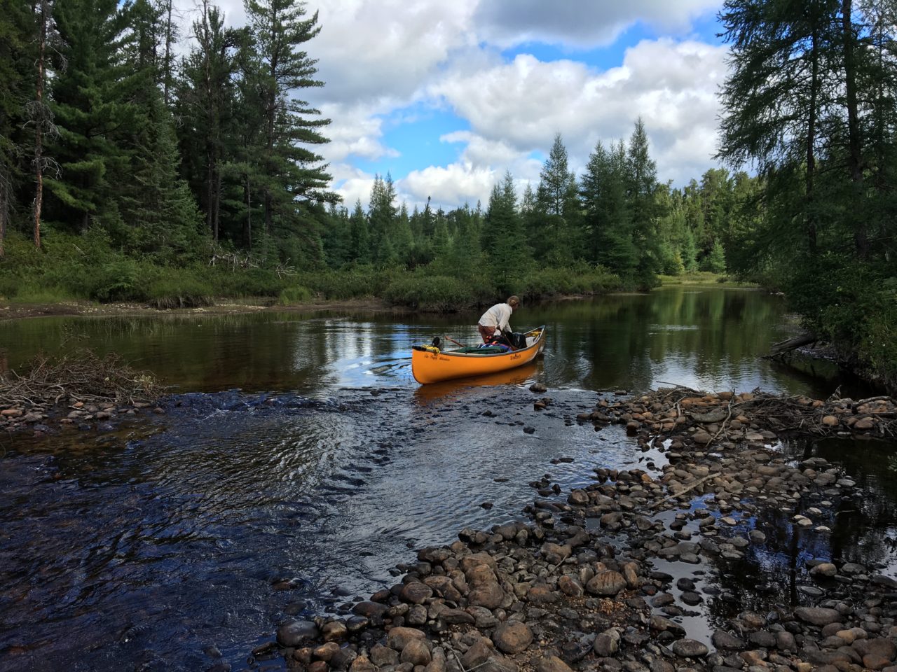
We paddled and portaged across two small ponds by way of overgrown 300m and then 60m trails, and when we reached the 600m portage into Lewbert Lake we met with another camp of composed of young girls (Northwaters-Langskib) who were following the boys’ group that had camped on Beaver Lake the night previous. Their goals were not nearly as ambitious as the Taylor Statten girls, planning only to move from Lewbert Lake to Beaver in a day… a move which took us less than two hours. They too were using wannigans and heavy Royalex canoes but these girls triple-carried everything, using a spotter who carried nothing for each trip across the portage. We were finding it very interesting to see the methods employed and the types of travel the different camps subscribed to. The amount of people we had seen in this region was rather shocking to us – we had been informed that the Pinetorch link was relatively unused because of its difficulty – but it was good to see several groups passing through as the portages were all very bushwhacky, most trails marked only with old axe blazes, and there is talk of opening up logging and mining close to this vast, virgin, roadless tract of wilderness. As long as canoeists continue to use these ancient routes and speak up about their preservation, we can hope to keep this area free of industry.
We had a leisurely early lunch on the Lewbert Lake campsite and charged some of our devices in the sun, then paddled northwest to the takeout for another portage leading to the Ames Creek. It quickly became apparent that we would now be climbing down from the mountain range we ascended the day before, and the ~800m portage was another tricky one which crossed right over the Ames Creek and then turned sharply north to a shallow bit of bog at the put-in. I was hot again, cranky, and I fell a couple times as I hurried to catch up with Andrew. I felt that I was at the limit of what I could carry, and I was worried that I was letting Andrew down by being slow and clumsy and a wimp. He not-so-patiently waited for me to get over it, and soon we were wading through muck again and dragging our canoe up to a massive beaver dam that marked the beginning of Skooztagan Lake.

skooztagan (bless you! sounds like a sneeze) lake
Every bit of information we had on this area said Skooztagan was a giant mud puddle, but the fresh dam helped to raise the water level by a good two feet and we paddled north with ease between high mountainous ridges to the far side, where we took out on a boggy patch and began a muddy ~400m walk to a small pond known as First Lake.

bogs, scratchy alders and labrador tea, these are a few of my favourite things
The portage could have been much longer if not for the beaver dam, and though my legs were scratched raw from the tangle of alder bushes and labrador tea we had been pushing through for days, I felt relieved that we only had one final portage before Florence Lake. We accidentally took the low-water takeout and extended this portage by an unnecessary 150m marked with axe blazes, but completed the carry quickly and with great zeal, our speed thanks in part to a need to outrun hungry deerflies.
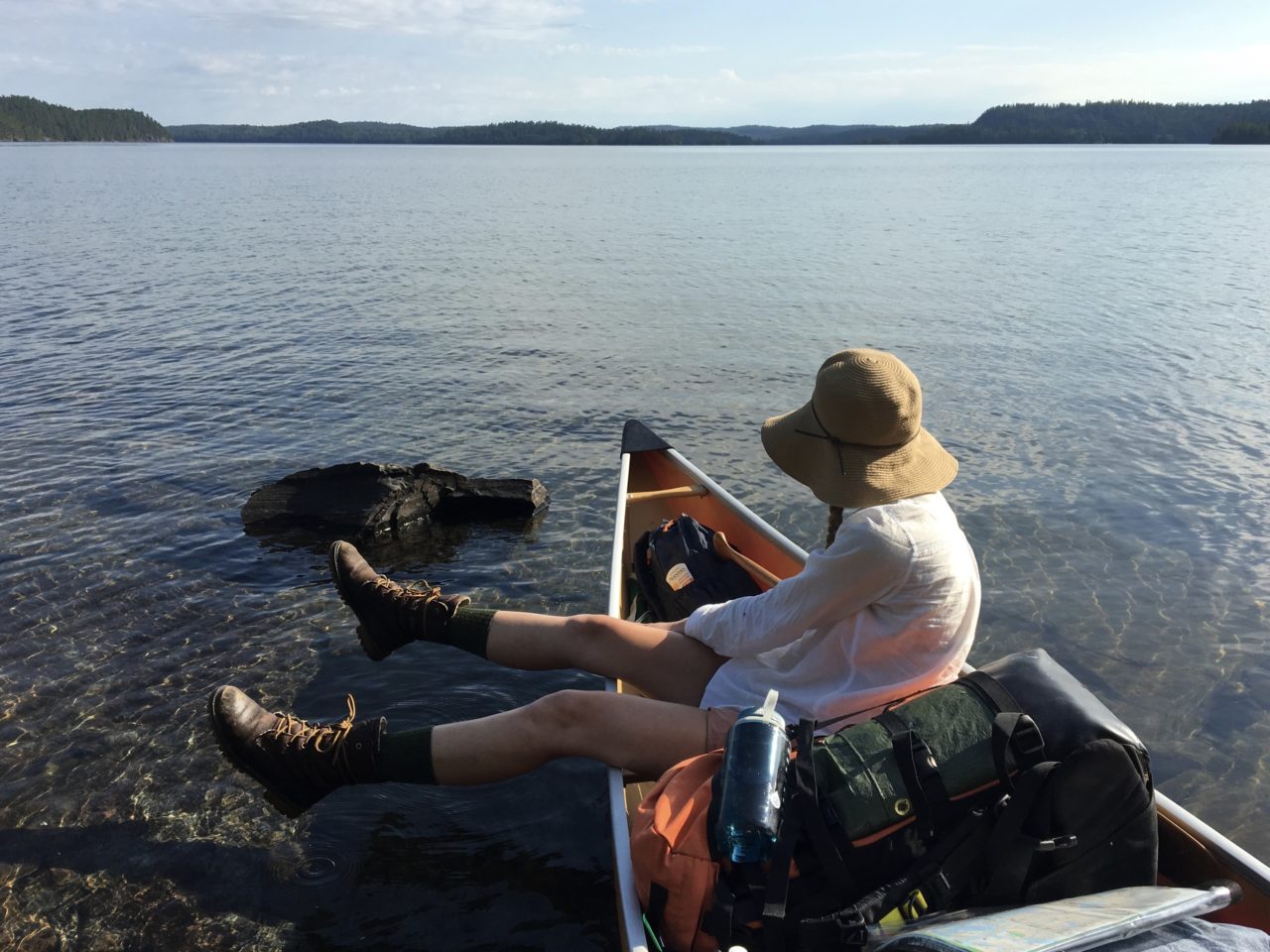
hellllloooooooooo florence!
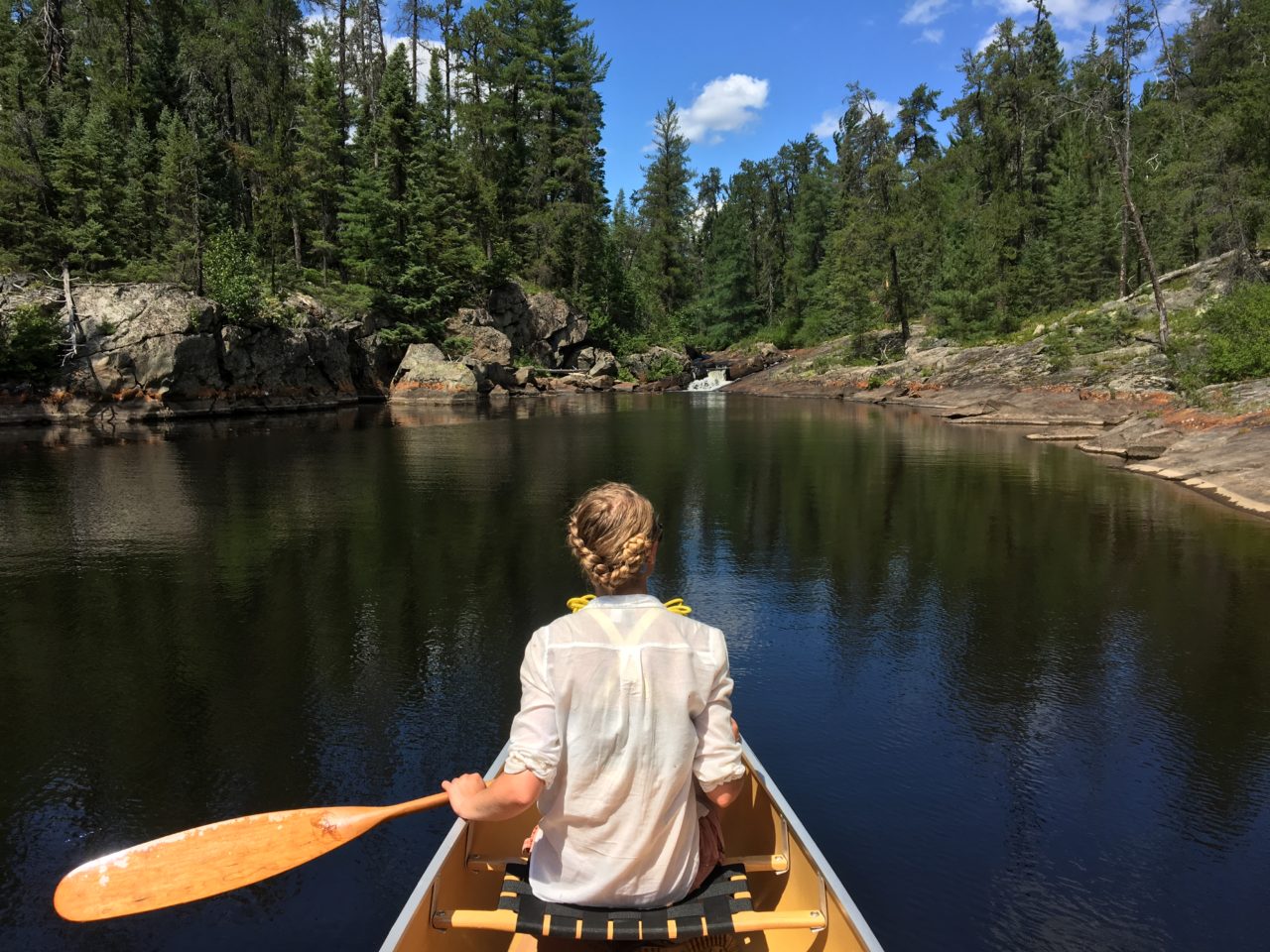
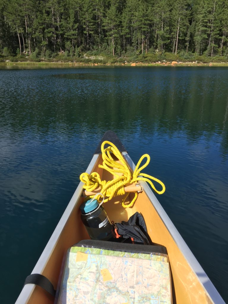
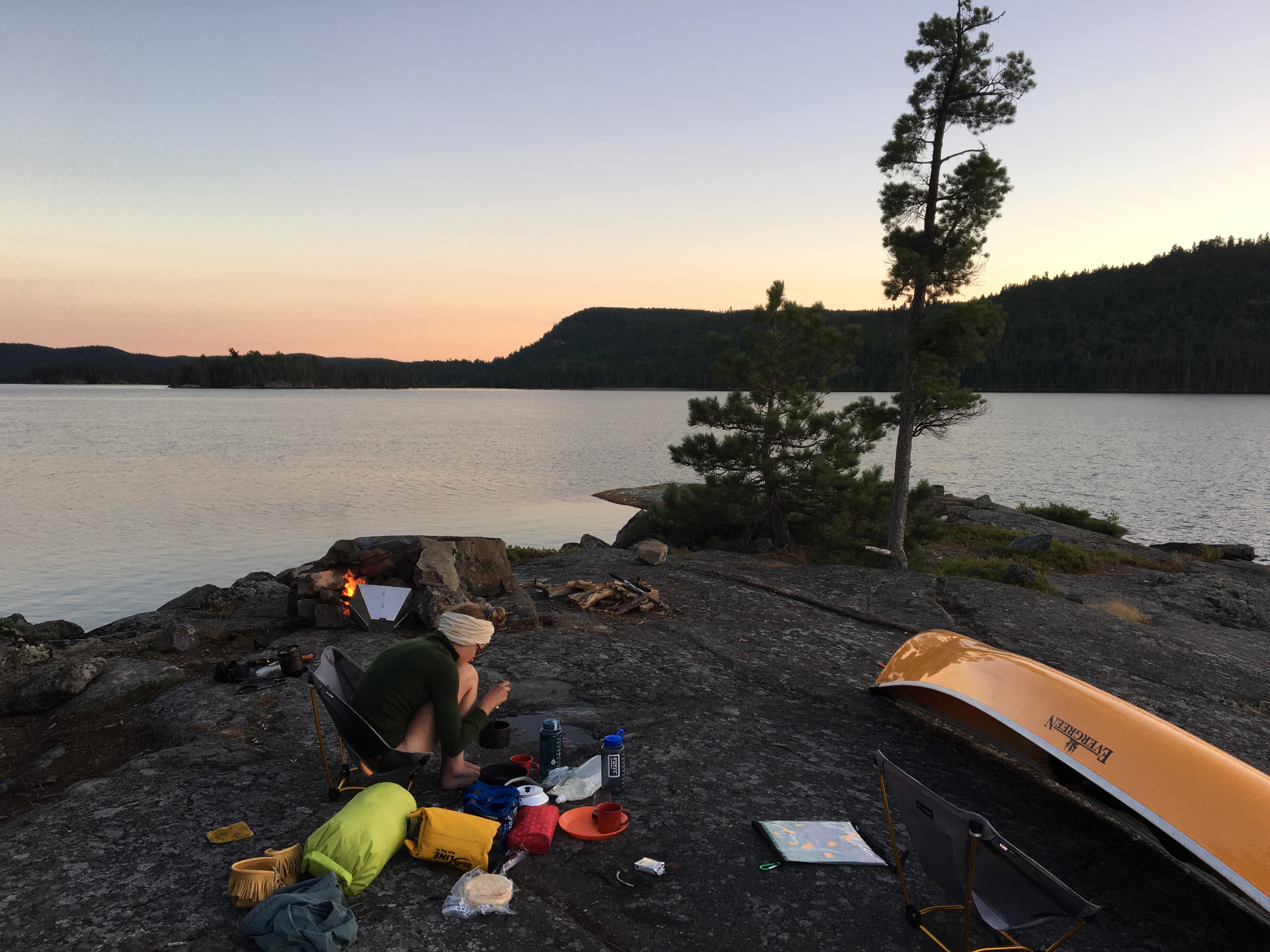
What a relief to be on big, beautiful, Florence Lake! We relished the feeling of digging our paddles deep into the water without hitting bottom and fairly flew 3km across the lake to a large island where we paused to take a celebratory swig of scotch. From far away we saw the Taylor Statten girls, who all ran screaming from the shore at the sight of our yellow canoe (they were probably naked again). Though the prevailing winds are generally from the south, we were facing a stiff breeze from the north (if we ever start a jug band, our name will be Always A Headwind), but we soon arrived at the Table Rock campsite which is located just under halfway across the length of this large, perfectly clear, staggeringly beautiful lake. The site was rocky and exposed, which we liked because it was catching a good breeze, but the tent pad had been colonized by ants and the firepit built right into the Table Rock, which we considered sacrilege. Table Rock is a dolmen stone: A large, flat rock propped up on many smaller stones. No one is quite sure how or why it was placed there. I left an offering of tobacco on it and rearranged the firepit to protect what was left of the site (it appeared heat from campfires had caused some of the smaller stones to collapse underneath the “table” – rather upsetting).

table rock campsite with improved fireplace built next to the “table”, not in it

our tent site, away from the fifty billion ants

crescent moon, crescent canoe
rehydrating pizza sauce
We set up our tent on a small patch of crispy, sun-dried blueberry bushes. We placed our boots in the sun, poured ourselves a glass of wine, and as evening fell we made pita pizzas with rehydrated pizza sauce, mushrooms, peppers, tomatoes, and fresh pepperoni and cheese. Extra cheese. We ate two pizzas each and stayed up quite late, watching a sliver of the moon rise and then quickly fall behind the hills. The temperature was quite cool, and before bed we lay down on the rocks on the point of our campsite and watched shooting stars streak across the sky. The next day would be a rest day, and we slept well knowing one of the toughest stretches of our journey was over.

goodnight, florence
Wow, this sounds like a more difficult trip than ever. Glad you enjoyed it and are home safe.
Mum
Just wait for the next installments, mum. More intense portages, waterfalls, and killer wildlife!
This sounds like an incredible trip. It’s great hearing the details.
Amazing pictures.
I can’t wait to read the rest.
Thank you! I’ll be working on getting the next parts up soon. The trip gets even more magical from here!
The big waters of Temagami… nice write up and great photos, Tierney! Too bad about Andrew’s paddle. Does Temagami just keep getting better and better?
Short answer, yes. Every day I spend there, I fall more in love. There’s just something about how rugged it is, the old pines, the jack pines, the way it doesn’t feel manicured like other parks.. It’s a very special place, as I’m sure you discovered this year as well!
YAY so happy this is up so fast!! love your adventures and that you are home safe and sound xx
Enjoyed reading your report, and seeing the lovely photos. I am unable to trip much this year, so I am getting some vicarious tripping in through your stories.
Nice trip and pics. You’re inspriring me.
Hate squelchy boots! You might consider switching to a trail runner or hiking sandal? They dry out much faster and I find them better in the boat too – more flexible.
Sounds amazing!!!
Awesome! Finally got around to reading it. You had me cracking up more than a few times. “sweating my lady-balls off” and “leave me here to die”. Brings memories of my big Temagami trip years ago covering similar areas. Look forward to the rest. Great job!
Haha thanks! I think what I’ve written for part two is even funnier, but I’ll let others be the judge of that.
Sounds like an excellent adventure. Glad your bear was with one that I consider educated, i.e. he’s just as worried as you are. Looking forward to reading part 2.
Cheers and beers
Pingback: If a Tree Falls in the Temagami Forest… | Back 2 Cool
Pingback: If a Tree Falls in the Temagami Forest… – Humber Digital Journalism 2016
Pingback: If a Tree Falls in the Temagami Forest… | the happy adventure
enjoyed the adventure I have been fishing Temagami for 20 years and as yourself I consider it my favourite place in the world ,I envy you your youth and spirit,I myself am 70 yrs young but have to enjoy this remarkable sacred place by houseboat ( Leisure Island Houseboat rentals) my youngest daughter has been accompanying me for the last 8 years on this annual fishing trip to our spot close to Devil Mountain at the end of may, needless to say she is addicted to this place, I will be sending her your link …..thank you Bill Gregory